EMERGENT TECHNOLOGY WORK GROUP - ED TECH REVIEWS
360 Media to Enhance Virtual Field Experiences
by Autumn Christensen & Jennifer Johns
Chemeketa Community College
June 5th, 2024
360 Photo (click and drag on the photo to control your view)
Exploration Intent
By allowing students to “wander around” the landscape and “explore” on their own, images taken with a 360 camera set students up for inquiry-based learning in which their curiosity and observations drive the experience.
Autumn Christensen is a geology instructor teaching both in-person and online classes and plans to use 360 photos and video to enhance classroom-based geology field trips. Jennifer Johns is a biology instructor working on a research project in a severely burned area in the Opal Creek Scenic Recreation and Wilderness Areas and intends to bring the forest to students through the use of 360 images.
Download the Transcript for this podcast.
Overview
Due to the generosity of the Emergent Technology Workgroup in funding our application for the Technology Exploration Grant, Autumn Christensen and I have been able to augment our students’ experiences in geology and biology, respectively. We are instructors at Chemeketa Community College in Salem Oregon who teach a diverse student population in this Hispanic Serving Institution. Our students come to us with a wide range of life, work, and educational experiences and we find the use of this technology helps to level the playing field, allowing us to use universal design principles in creating virtual field experiences. The exploration of geology and the ecological side of biology really demands time in the field, and yet, some of our students have barely left the suburban setting in Salem, while others regularly hike or hunt or fish all over the state.
The use of 360 videos truly allows students to investigate field sites regardless of their comfort level with “being out in nature” and provides several different opportunities and advantages to conducting our courses without this technology.
First, the use of this technology allows us to bring the field to our students. This can be an advantage for a number of reasons. Field locations can be distant from campus–even in the tropical rainforest–or difficult to get to–needing 4-wheel drive vehicles, and so having videos from these locations allows students to explore places they otherwise would not have access to.
Second, traveling to field locations can be time consuming. Many of our students work full time, are raising children or have responsibilities to take care of a sibling or parent and are trying to complete their associates degree in a timely fashion. Asking them to attend a field trip that extends beyond the normally scheduled class time is often untenable. If some students go on the field trip and others cannot, it leads to an uneven experience for the students. Having the field trip available online through the 360 videos solves this problem.
Third, virtual field trips augmented with 360 images and videos allows students to “attend” the trip in all kinds of weather, which expands our ability to offer the courses throughout the year. One of our field locations is regularly snowed in from October through April, which effectively eliminates either teaching the course which uses that field location during our Winter term, or precludes going to that really awesome site if the course is taught during the winter term. Having the location accessible through the 360 technology allows us to teach our classes in every term. Moreover, the control the students have of the images really allows them to explore the site and collect enough preliminary data to formulate testable hypotheses. (See below for more on this project.)
Finally, access to this technology has allowed Autumn to develop labs for her fully online geology class.
In addition to using this technology to develop our lecture and lab courses, we have also been working on adapting our 360 images and videos for use in Chemeketa’s Planetarium. Each of us is working on the idea of creating a planetarium show for the public that would include professionally produced videos about a particular topic in geology or ecology (wildfires, for example) and then would bring the issue home by showing our images and videos from local sites.
Current Projects
Autumn Christensen
Virtual field trips have been my primary focus. I have used several in the past for both online courses, and face-to-face classes. In the online setting there is little opportunity to get an entire class together for an in-person field trip. In the past I have used a combination of Google Earth, standard photos, and pre-recorded mini-lectures. These are somewhat limited as there is not a lot of opportunity for exploration and the set-up becomes a lot of direct question and answer. With 360 videos and photos I’m hoping to add an additional tool for my online students, and expand the opportunity to let students explore an area before answering questions, or even posing their own.
For my face-to-face classes, online field trips have often been a supplement for extra credit, or to make-up in-person trips a student could not attend. I have three such trips I primarily use in my GS106 Earth science course. I have gathered 360 images and videos for Silver Falls and the Oregon Coast around Newport to improve and expand these two activities. I am also taking inspiration from The Virtual Field, which is a group of instructors and field workers generating 360 videos with accompanying assignments and archiving them for use by instructors around the world (primarily biology and ecology related). Their specific questions and videos are less helpful to my goals, but their formats for questions and assignments I hope to take and add to my field trips to improve the immersive aspect, and allow more opportunities for students to explore an area they may or may not have been to before in person.
I still hope to use the planetarium, and did bring a geology class through our High School Partnership program there to run our class field trip. Because many of the students were from different high schools, arranging a field trip was extremely complicated, if not impossible. But going to the planetarium offered me the opportunity to show the students the field locations, and work through the same activities as an in-person class could offer. There is still a lot of work to do here, but the experience left me with hope for what could be done in the future.
Jennifer Johns
Currently, I have mainly used the 360 camera to film videos of my research location, Opal Creek Scenic Recreation and Wilderness Areas. This area was severely burned over Labor Day weekend and the following week in 2020 by the Beachie Creek Fire. As an ecologist, who also teaches environmental science, I knew that getting to the site to collect data about the recovery would be a compelling project for my students as Marion County (our service district) extends well up towards the area of the fires and students from all over the Willamette Valley have very strong memories of that time when the sky was orange or black for days (depending on how close you were to the fire.) As of yet, though, the site has not been deemed safe for student groups and even when it is, accessing the location requires a considerable time investment to drive along poorly maintained gravel road and then hike into the site.
Accordingly, I have made videos of all six of our sites (Gold Creek, Hewitt Old Growth Grove, Merten Mill, Opal Pool, Skyhouse, and Battle Ax Creek) in the Opal Creek Scenic Recreation and Wilderness Areas for students to examine and placed them in this Opal Creek YouTube Playlist for students to use as a basis for formulating hypotheses about the recovery. In this play list you will also find professionally produced videos that describe the location before and after the Beachie Creek Fire. I include these videos to give the students context. I then give them access to a tailored data set that allows them to explore their hypothesis, analyze the data, and draw conclusions. The write-up for this unit is in the format of a scientific poster. I piloted this unit with my students this year and am excited to say that the whole unit will be uploaded to a site I work with as a Faculty Lead, called The Virtual Field later this summer.
Lessons
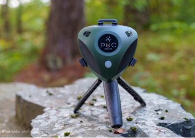
Use of the camera has proven to be fairly straightforward. The Insta360 camera we have, along with the Insta360 Studio program to process images, are user friendly and the default options seem to be working for our intended use. We have some work to do with the ipad we purchased, needing to get it optimized so any instructor can use it, so we haven’t had the opportunity to use the ipad in the field in conjunction with the camera. The hope would be a singular device to both run the 360 camera, and take standard images on, limiting use of personal phones or other equipment.
Embedding and presenting photos for student use is still something being discussed. Jennifer Johns is using Youtube to store and share her videos with students, while Autumn Christensen is using a combination of Google Photos and Kaltura. Part of this is that Autumn is using more photos overall, while Jennifer is primarily using videos. Regardless, there is some issue keeping all material easily available in Canvas, with links to either Google or Youtube being required. Videos are possible to embed in assignments, but photos seem to be more limited in that ability. It would be better to keep material in one place, but with the current programs available to us at Chemeketa that may not be an option.
The planetarium has proven the biggest hurdle. There is a delicate balance between the program running the 360 video or photo, the quality of the file, and the projector itself. We’ve had a lot of back and forth trying to optimize the projection on our dome without the images and videos becoming washed out or distorted too much. These issues and complications are easier to work around with our own classes, and both Jennifer and Autumn have brought classes to the planetarium to work with 360 videos. And we have made some progress in getting a reasonable projection with our current set-up, but there is still some work to do if public shows are going to be attempted using 360 images. It’s not just the projection quality, there are issues with being able to run the different projectors in the room, the access of computer screens for the presenter, as well as the inclusion of sound for videos.
Further Investigation
Autumn Christensen
I hope to continue collecting 360 images and videos, even if I don’t have a specific assignment I plan to use them in. A database of these videos would be wonderful to have as a tool for myself as well as other geologists on campus. Including them in my lectures, or creating new labs around them, would be an excellent way to further benefit from having this camera. My extra credit field trips may turn in-class visits to the planetarium to run together as part of our regular lecture.
The goal for public shows is still a thing for me, but is some ways off as we must figure out what best works to present 360 photos and videos without cutting off the opportunity to play other things on the dome. We’re working closely with the director of the planetarium about what programs work best, what can be done with the set-up in the planetarium to offer a better balance of programs and projectors, and potentially getting a new projector for the room. My hope is to have similar public shows to what the planetarium already does, presenting a premade video on some topic (geology related instead of astronomy) supplemented with a presentation related to local geology showing our 360 images of the area.
Jennifer Johns
The possible uses of this technology for me in the future are many. The low hanging fruit in my future pursuits is to continue using the 360 camera to take images and videos of my field location at Opal Creek to document more of the change over time of the recovery. I am exploring the possibility of using some sort of time lapse feature to eventually compile the first five years of images. In addition to our work on the vegetative recovery of the site after fire, we are also adding other organisms to our list of species recovered including mosses, lichens, amphibians, and birds. I can see using this technology to take some very specific photos and videos, particularly around the recovery of moss and lichen.
Additional uses in the future include:
Local field trips for BI101 Ecology and Diversity, BI131 and BI132 Environmental Science. Because these field trips are local and fall mainly within the timing of the lab, it is less of an issue for students to attend, but creating a 360 version of the lab would still be good for accessibility. Additionally, creating a pre-lab assignment that had students explore the site first by making their own observations would increase our efficiency in the field and could increase the comfort level for some students.
In BI101 we used to take students on a day-long trip, stopping at 6 locations between Sweet Home, Oregon and the Head of the Metolius River near Camp Sherman, to illustrate the effects of precipitation and elevation on plant community composition and diversity. The pandemic forced us to make that a virtual field trip over the course of a week. We had hoped to reinstate the field trip as an in person trip in the years since returning to in person instruction but the budgetary constraints have prevented that outcome. This year we have decided to create a second local field trip for BI101. While disappointing to give up the in-person field trip, this situation does open the opportunity to create a 360-video experience from those same locations that can be used as an in-class or at-home enrichment activity when we study community ecology.
Finally, also during the pandemic I made a virtual field trip for my marine biology class that explored both an estuary and a rocky intertidal zone. This class is also back in person and the field trips do go in person to the Hatfield Marine Science Center but like BI101, a 360-video of the locations set up as a pre-field trip experience would be a huge benefit to help students really understand the sites before we arrive so they could make realistic plans for their observational studies.
360 Photos & Videos
Click and drag on the photos or videos control your view.
Beverly Beach Cliff Deposits - 360 Photo
Devils Punchbowl North Side - 360 Photo
Silvercreek South Falls Behind - 360 Photo
Devils Punchbowl South Side - 360 Video
Devils Punchbowl North Side - 360 Video
South Falls Into the overhang - 360 Video

TECHNOLOGY EXPLORATION
Do you have an emergent technology you would like to explore? Submit your nomination for a technology evaluation by the OCCDLA Emergent Technology Workgroup.
The OCCDLA Emergent Tech Work Group receives nominations for instructional technology review from work group members and our nomination form, available to all instructors and administrative staff of all Oregon Community Colleges.
Questions?
For questions about the Emergent Technology Work Group:
Administrative Contact:
Monica Marlo
Portland Community College
monica.martinezgallagher@pcc.edu